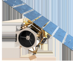
The GeoEye-1 satellite, launched on September 6, 2008, collects images at nadir with 0.41-meter panchromatic and 1.65-meter multispectral resolution. (Imagery sold to commercial customers is resampled to 0.5-meter resolution.) Just as important, 3 meters of inherent geolocation accuracy has never before been achieved in any commercial imaging system.
Location
CP 2156, First Floor, Sector 16A, Vasundhara, Ghaziabad-201012, U.P, India
201012
Ghāziābād
Uttar Pradesh
India
28.66535, 77.43915
Get directions →